
Biking the Bitterroot
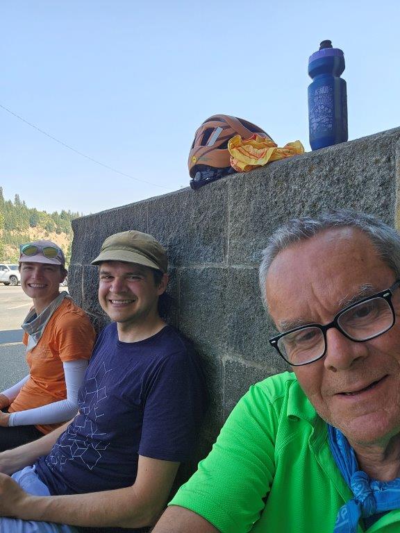
Riding the Bitterroot 300 has been our bucket list basically since moving out west. When Andrew’s dad, Papi/Ramon, mentioned he was going to ride it this year we were eager to tag along / take over his trip. For those that don’t know, the Bitterroot is a compilation of various rail trails making a 300 kilometer loop near the Bitterroot Mountains in Idaho. The route strings together the Trail of the Coeur d’Alenes, Northern Pacific Trail (or NorPac), Route of the Hiawatha, and the Old Milwaukee Railroad Trail. There is about 22 miles between the towns of St. Maries and Plummer, Idaho that unfortunately don’t have a trail, so you either need to shuttle across or ride on a busy hilly highway with narrow shoulders; we opted for the former.
We did our ride July 17-20, 2024 and it just so happened to be during a heat wave with temperatures nearing 100 degrees every day.
Day 1 -
Trail of Coeur d'Alenes
9 miles (Total: 9 miles)
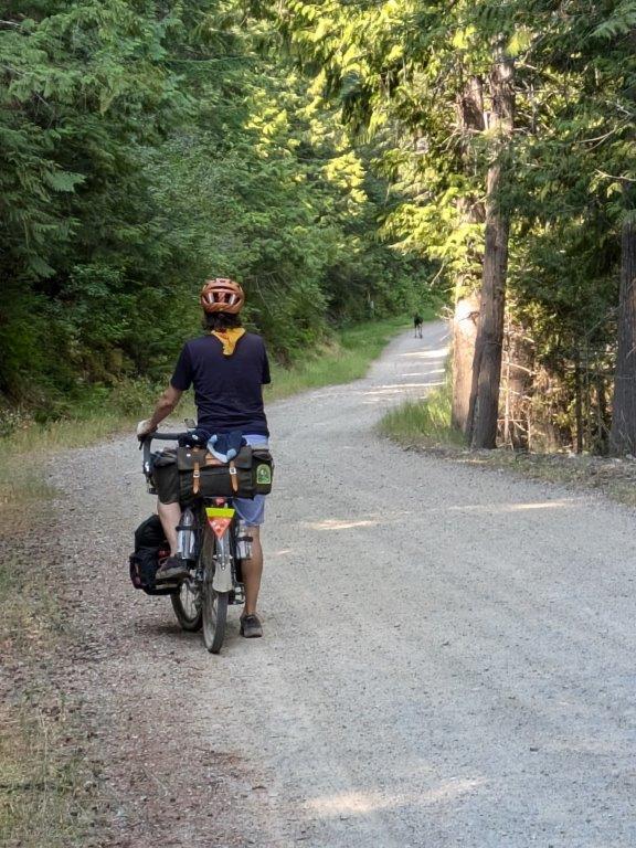
Day 1 involved a long drive and a meetup. Andrew and I were coming from Portland (7hr drive) and Papi from Seattle (6hr drive). The three of us met up in St. Maries, Idaho so that we could do a car shuffle* to avoid riding on the highway portion of Bitterroot. Our ride started at the Trail of the Coeur d’Alenes Trailhead in Plummer (well technically at the hardware store nearby where we parked Papi’s truck, but you get the idea). The Trail of Coeur d’Alenes has a unique history to it. It’s an old rail road line converted bike path which in itself is pretty common in the US, but because the railroad bed was originally constructed with Silver mining waste, the area is full of heavy metals. To help protect the environment from the toxins and heavy metal, the thick layer of asphalt actually seals it all in creating a clean barrier. Conveniently, that asphalt makes for a very smooth bicycle ride!
Our first day of riding was glorious. It was the sort of smooth downhill riding that makes you wonder ‘why don’t more people ride bikes? This is fantastic, and so easy!’ Granted the access into the Chatcolet Campground, part of Heyburn State Park, where we were staying for the night quickly reminded us that we would actually have to pedal on this ride. Andrew had stopped at the trailhead that is probably the intended route up to the campground, but I had quickly looked at the map and said “if we keep going there’s a direct route to the campground!” Turns out that “direct route” was a steep 3ft wide dirt path, not the easiest for loaded bikes, but it was direct! And our campsite was literally at the top of the trail. So I’d say it was a success.
*Note: there are shuttles you can pay for to have people get you across the highway portion if you do this ride and don’t have an extra car to shuffle like we did.

Day 2 - Trail of Coeur d'Alenes Cont'd
59.7 miles (Total: 68.7 miles)
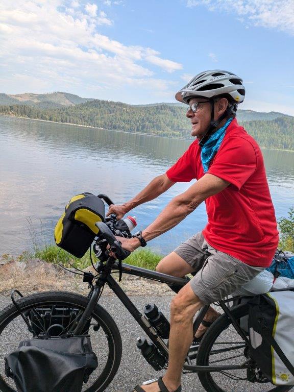
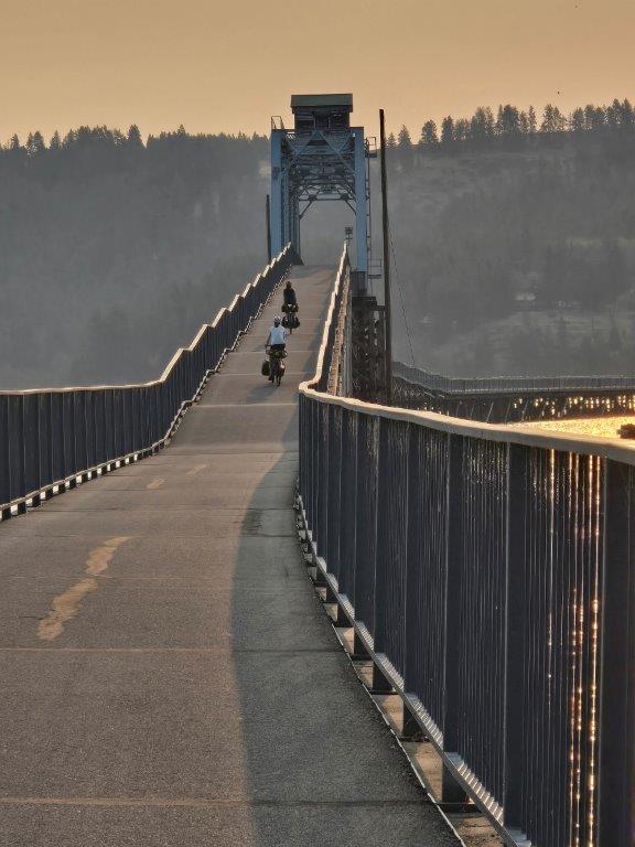
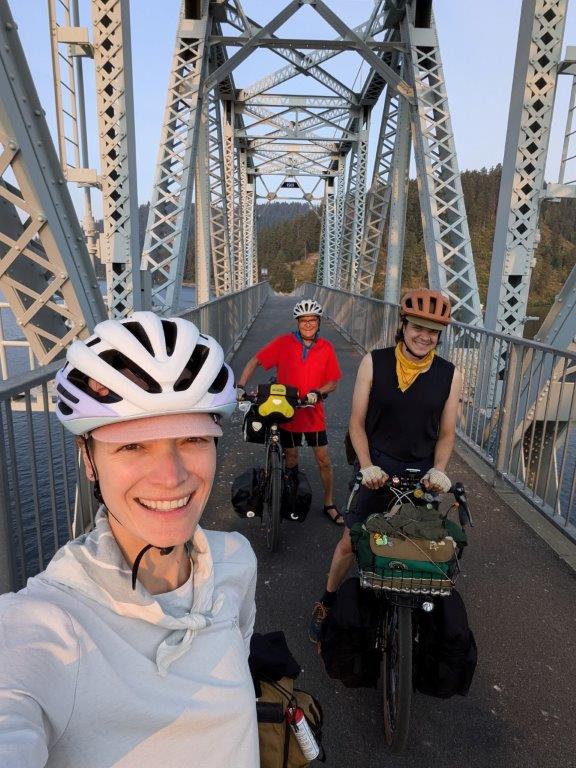
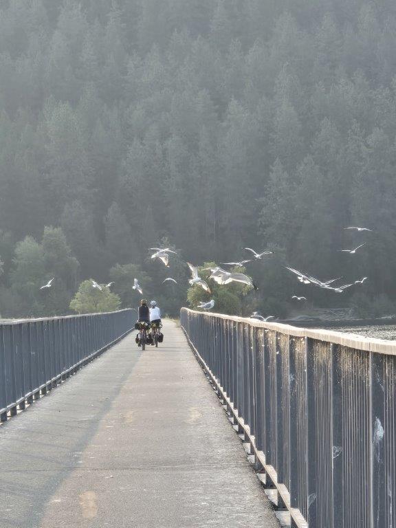
Day 2 was our first full day of riding. We had woken up fairly early thanks to the 5:15am sunrise. But also, it was the middle of July and a heat wave (bad luck on our part) so we were eager to get on the trail before it got too hot. Within 5 minutes of riding we were already distracted by the trestle bridge crossing the Coeur d’Alene Lake. We spent so long taking pictures before finally rolling on.
The early portion of our ride offered amazing views of the lake which also kept us nice and cool. As we made our way further north and started to follow the river we even had our first moose sighting! Papi had spotted a Mama moose with her baby. After cautiously admiring the moose from a not safe distance (maybe 10ft away) trapped between us and the river we eventually carried on congratulating ourselves on our luck and how cool it was to see 2 moose! Turns out that was just the start of a moose filled day.
As we continued on, we played leap frog with a few other riders out on the trail. Some of those other riders spotted 3 more moose in the marsh and pointed them out to us. We of course stopped to take more pictures feeling much less threatened by those three being a good distance away. As the day wore on, we saw another moose with huge antlers across the river, but mostly obscured by shrubs. But finally as we were nearing our 40th mile we spotted a moose just off the trail in the river. He was having a grand ole time cooling off and slurping up the cold water. We were a little jealous, as it was definitely starting to get warm out. 7 moose in one day!


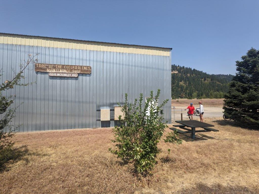
We stopped for a bean burrito lunch at the trailhead in Smelterville, which didn’t leave the greatest of impressions on us, mostly because it was sweltering hot by this point, and the trail had veered away from the river and left us with next to no shade. Since the temperatures were nearing the 100s we were in need of cooling off and a water resupply. (Since the area is so heavily contaminated by heavy metals there are signs all along the trail telling you not to even drink filtered water from the river). Fortunately, not even 5 minutes after we left Smelterville we passed by a metal building labeled “Trail of Coeur d’Alenes Maintenance Shop” with a water spigot outside fitted with a drinking fountain head. That was enough for us to decide it was probably safe to drink water – it’s now two weeks later, and still not dead, so success!? We were also able to drop our body temperatures down a bit by soaking our shirts and accessories in the cold water.
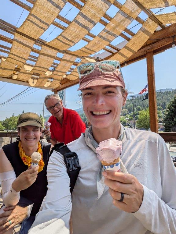
Kellogg, our next trailhead would have made for a better lunch spot, but because we had already eaten it made for the perfect place to stop for our favorite treat, ice cream! I guess we didn’t need to spend so long at the water spigot cooling ourselves off after all.
The rest of the ride into Wallace came with a bit of an uphill. And with the heat we were definitely slowing down. We started to take shade breaks every 30 min whenever we could, but it was definitely slow going. We rolled into our campground in Wallace around 3:30pm eager to get out of the heat. We all got into the shallow creek nearby to quickly cool down until we were ready to venture into town.
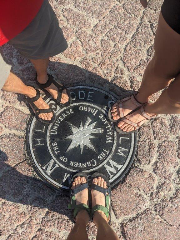
Wallace is the center of the universe. Or at least their 2004 mayor claimed it as such, and you can’t prove him wrong. So just in case the mayor was right, we obviously had to go for the photo ops. Afterwards, we stopped by the grocery store, showered, and treated ourselves to a dinner out with beers.
That night we stayed at the Wallace RV park, it was only marginally more expensive to stay in a cabin compared to pitching a tent, so obviously we got ourselves a cabin. Unfortunately the cabins were designed for Idaho’s usual cold nights and so it ended up being a little too warm in there, but it was nice to not have to sleep on the ground or pitch the tents.
Day 3 - Route of the Hiawatha Plus
48.5 miles (Total: 117.2 miles)
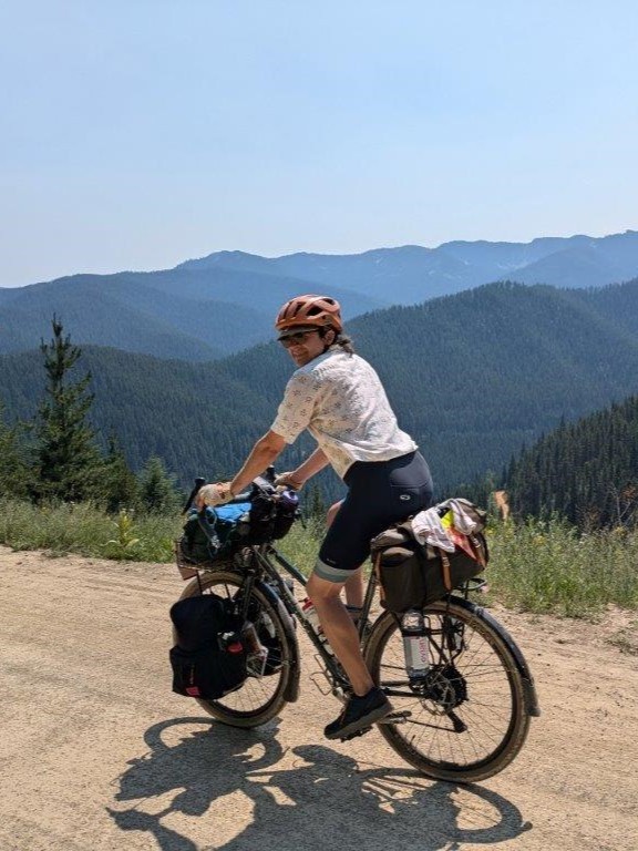
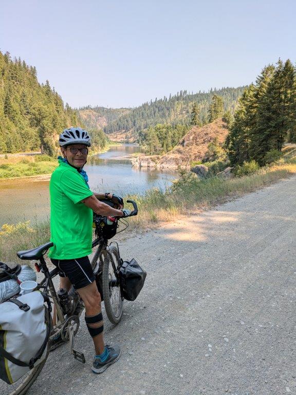
We had about 7 miles of paved trail riding left to Mullan before our ride would switch to gravel. Day 3 was the climbing day, 2600ft of climbing, but the reward at the end, the Route of the Hiawatha, would be well worth it.
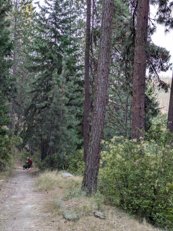
After a pitstop at a convenience store in Mullan for some Idaho Spuds, a chocolate coconut marshmallow candy that appears to only be sold in Idaho and Eastern Oregon, we had to make our way over to the NorPac Rail Trail. There was some differing opinions in the Bitterroot route from the internet and our paper map. We ended up taking an extra steep rocky road up to the Stevens Lakes Trailhead which did shave a couple miles off our overall distance. The NorPac Trail itself is a fairly rocky trail. It was a rocky enough trail that you really had to pay attention to what you were doing, but being a rail trail it wasn’t too steep – although this rail line must have been designed for small trains because it definitely wasn’t your typical “rail trail” grade.
On the NorPac, we only saw one person out in their 4 wheel car. They passed us back by the Stevens Lake Trailhead while we were having second breakfast. After hours of solitude we felt we were in very remote parts of the state, although you could still hear the I-90 traffic from down the mountain. We were excited to pass a ski lift decommissioned and abandoned for the season. It was cool to see the infrastructure to support crowds of people juxtaposed with the feeling that we were the only ones out there. Notably, as we rolled up to a clearing near the top we found two vanlifers camping out, and I remember thinking to myself, wow what a cool remote spot they found only to round the corner to a massive ski resort with bike rentals, food, and a gift shop: Lookout Pass. Wah wah, so much for being remote. At least I was able to buy myself a souvenir sticker.
Making it to Lookout Pass meant we were done with our first climb at least. And bonus, we made it to a new state, Montana! From Lookout Pass we had a gloriously amazing 9ish mile gravel downhill. All our effort of the morning climb was paying off!
But as it turns out, downhills can’t last forever, and we had another 2 mile uphill to the East Portal Route of the Hiawatha Trailhead. The afternoon climb was less than 500ft in elevation gain, but that was the hardest climb of the entire day. Probably thanks to the rising temperatures and the effort we had already put in that morning. I did end up needing to walk my bike up that last bit of climb.
Some people say you can only check off visiting a state if you eat a meal there. This was my first time to Montana, so does eating a self made sandwich with ingredients I had bought in another state still count? Well if not, surely riding a bike for 13 miles does. We enjoyed hummus wraps in the shade at the East Portal Trailhead feeling utterly exhausted from our climb while all the bicycle tourists from the Hiawatha Trail cheerily went by us. It wouldn’t be long until we were one of them, crossing back into Idaho on the Route of the Hiawatha.


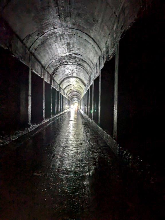
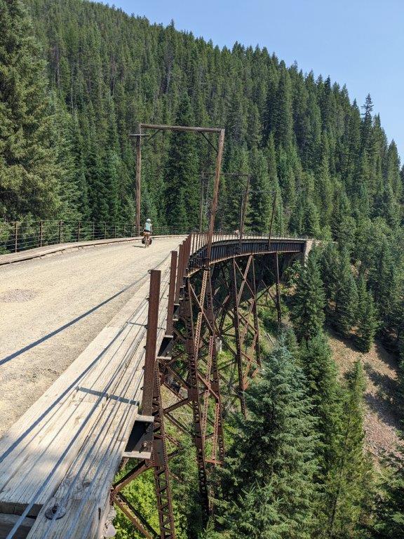
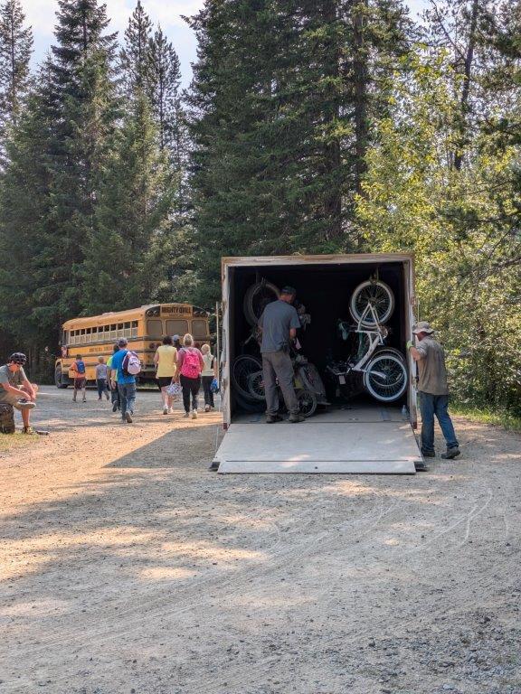
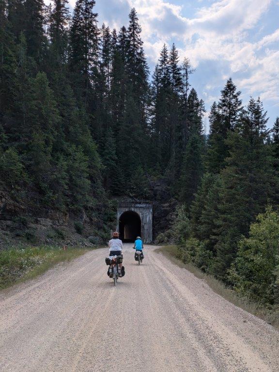
Do you wanna know how to enjoyably ride your bike in 100 degree temperatures? Downhill tunnels. The Route of the Hiawatha is a 15 mile long downhill rail trail gravel path with 10, yes 10 tunnels! As if that wasn’t enough there are also 7 “sky high trestle bridges”. It was such a cool ride. The trail was very well groomed (a relief after the rocky Nor Pac) and there were multiple bathrooms and water jugs along the route. I would highly recommend it to anyone who is in the area. You don’t even need to be that strong of a bike rider, it’s all downhill and you can pay for a shuttle back to the top! Albeit the shuttle did have a really long line when we reached the bottom.
The first tunnel was over a mile and a half long, and was oozing cold water on the sides meaning we came out of there delightfully cooled off, but also absolutely covered in tunnel mud. We’re still trying to clean that silty mud off our bikes and bags! Worth it. Every time we started to get a little hot, another refreshing tunnel would pop up and be there to cool us off. The views of the mountains and the bridges were incredible, the work that must have gone into surveying the route was undoubtably crazy
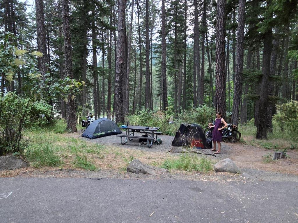
And if 10 tunnels weren’t enough, we actually went through several more after leaving the Hiawatha as we continued down the Milwaukee Scenic Alternate Trail to the St Joe River where we were planning to camp for the night. At some point we came up to a turn that would take us down to Telichpah campground, a Forest Service Campground with minimal amenities. Looking at the steep hill down to the river and our three conflicting maps we weren’t sure that we wouldn’t have to climb right back up in the morning so we opted to stay on the high side and test our luck at finding a dispersed campsite. But, after one too many cars passed by us we noticed a gravel trail on the east side of the river that looked much more pleasant so we backtracked to the turn and proceeded to Telichpah where we opted to camp for the night planning to stay on the east trail come morning. Some day users had conveniently held the campsite right by the river for us. We had gone down to the river to cool off (and clean up after the muddy muddy tunnels) and when we found out they would be leaving soon, we were more than happy to set up our campsite right by the river.

Day 4 - Old Milwaukee Trail
54.2 miles (Total: 171.4 miles / 275.8 km)
The first 5 miles into Avery were glorious and tough. It was a surprisingly challenging route following the St Joe River probably mostly enjoyed by ATVers today. From the campground, we stayed on the east side of the river which was closed to vehicles, although the actual Milwaukee Scenic Alternative Trail was on the west side of the river and happily used by local drivers. We were happy to be by the river and enjoying the technical challenge of our morning ride. But we were also glad it didn’t last too long, because it was slow going.
In Avery we stopped to refill our water bottles and buy some more Idaho Spuds. We crossed the river and continued on the remote Scenic Alternate Trail. So remote we found ourselves accidentally following a moose for almost two miles! They just wouldn’t leave the trail and so we had to awkwardly chase behind them at a whopping 3mph ringing our bells and shouting “move along little moosey” from a very safe distance back hoping they wouldn’t be bold enough to turn around and charge us. Eventually they did leave the trail, but that encounter along with the slow early gravel riding lost us a lot of time in the cooler temperatures of the morning.

Eventually we made our way over to the Old Milwaukee Rail Trail which started out with lovely river views and smooth pea gravel. Unfortunately as the day wore on, the quality of the gravel road diminished with more and more washboard sections, and there seemed to be a car passing us by every few minutes bringing with it a big cloud of dust. I suppose it was a Saturday and a lot of people were using the trail to gain access to the river to cool off but it was not making the ride any more enjoyable.
When we rolled into Calder it was time for a cool down break so we bought cold drinks and ice cream and took a rest. Papi decided he was sick of all the washboard gravel especially with the rising heat and so we decided to cross the river and ride the last 20 miles into St Marie on the paved St Joe River Road. Let me tell you, the feeling of riding on pavement after hours of gravel riding is amazing. We got into a tight little pod and were hauling ass down the road. Zoom Zoom we were so fast, you’d think we were a gaggle of lost roadies! Okay okay, not that fast but still pretty fast for some loaded tourers.
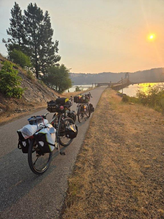
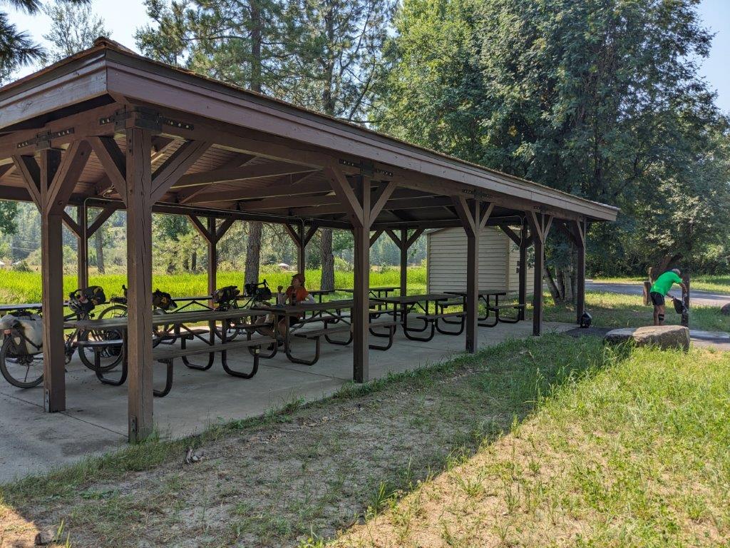
The heat of the day was really getting to us though, and it was harder to find places to stop for a shade break along the main road. Fortunately Shadowy St Joe Campground was a savior. As we (maybe just me) were reaching the end of our line in terms of heat capacity, the brown sign for the campground sparkled in the distance like a mirage. Would it have water or shade? But it was no mirage, a true oasis! Just off the road was a huge covered pavilion, bathrooms, and the real MVP of the day: the blessed water spigot. We spent a solid half hour cooling off watering ourselves and our clothes down and resting in the shade. We were even able to clean some of the mud from the previous day off our water bottles and bags.
Rejuvenated we were able to finish off the last 11 miles into St. Maries where our car was waiting at a fully stocked grocery store. I can’t remember much of that last bit of riding. I was so hot I mostly remember staring at the white line or the tire of the person in front of me, plus there was some really terrible singing resonating from within our pod to keep us focused, but the sense of accomplishment we got rolling into the grocery store parking lot was well worth it. We bought beer, wine, 3 cans of pringles, a pint of ice cream, and pancake mix and syrup for the next morning to celebrate – bike tour metabolisms are the best!
We camped one more night at Heyburn State Park, this time Hawley’s landing, which came with showers, before parting our separate ways in the morning.
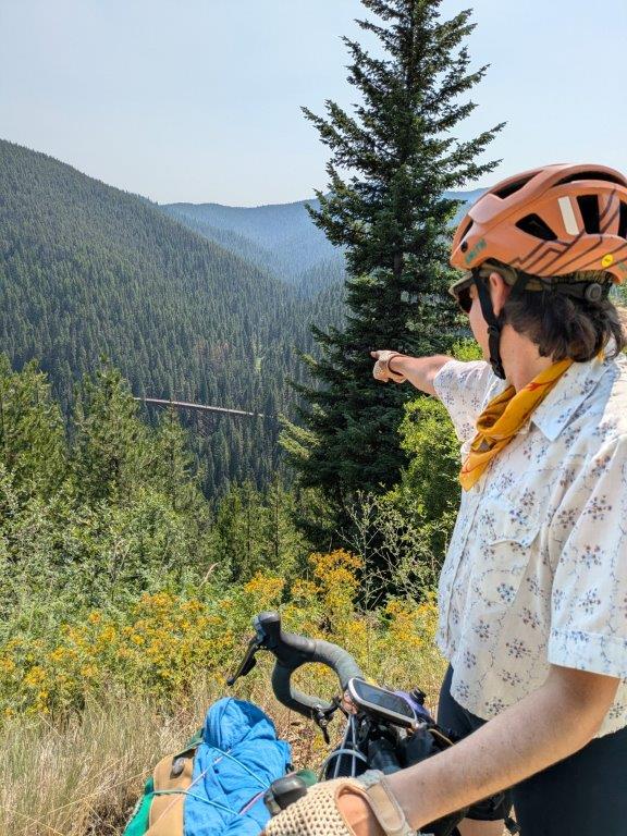
Overall it was a beautiful fantastic route. The friends of the Coeur d’Alenes Trail recommend you start the Bitterroot 300 in Wallace to get the big climb out of the way first, but my main takeaway/advice is don’t do it during a heatwave. It was painful to see that the following week would be 20 degrees cooler, but c’est la vie, you can’t predict the weather. Some of the transitions between trails weren’t always the most obvious, we had 2 times in our trip where I stopped us and pointed across the river saying “I think we’re supposed to be over there”. Nothing a little backtracking couldn’t solve. So if you decide to do the route you may want to buy the gpx files, or just study the maps better than we did, or be like us and throw in a couple extra pedal strokes as you realize your mistakes. You can request a free paper map from the friends of Coeur d’Alenes website but it traded some functionality for artistic choices so I wasn’t particularly impressed with it, but it was also free so I can’t complain too much. We figured it out in the end though, so I’m sure you can too!

**Many thanks to Papi for letting us tag along on his trip and providing us with some excellent photos to share!
You May Also Like

