
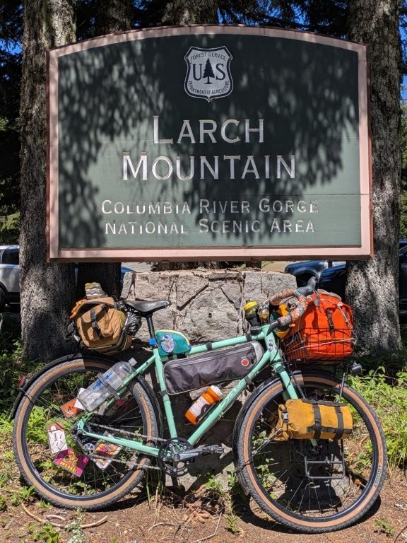
Launching Up Larch Mountain
As some readers may already know, our cat, Little John decided that he really didn’t want us to go anywhere this summer. On May 30 (two days before “Bike Summer” started, a Portland, OR three-month festival of bikey fun) Little John fell from a very short windowsill fracturing his back leg and rupturing his ACL. He’s had surgery and getting way more rest than he wants. He needs to be confined to a kennel or under constant supervision but he seems to be recovering well so far although we expect it to take about 8 weeks before he’s back to his usual self.
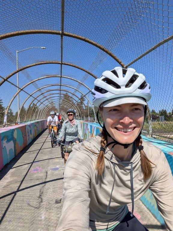
Happy to have an excuse to relax at home, Andrew opted to play care taker while I went on our apparently annual trek up Larch Mountain. Yes, this was my first time bikecamping without Andrew, but fortunately I was not alone, it was me and seven other friends attempting the trek up the mountain this year.
Larch Mountain is just over 4000ft total with a paved road to the top offering amazing views of the surrounding snow peaked mountains. Being just east of the city it is a popular destination for “roadies” (what I call the fast cyclists usually kitted in lycra). Larch Mountain is also (as of writing this post) mostly National Forest Land which means free camping in the woods! A perfect weekend bikepacking destination.

June 7, 2025 - The Endless Climb
Distance: 42.5mi
Elevation: 3,433ft
Bruce was our fearless leader for the ride so he invited us over to his place for delicious homemade coffee cake, a crafty ploy to have a convenient starting location for him I’m sure. Since this was his route, he set himself a challenge of getting out of town without getting on any busy roads, but also avoiding the I-205 bike path and he managed to achieve that pretty well all on memory. We had made a wrong turn at one point, but what we thought would be a mile on Foster (a busy road) ended up being a short jaunt to an entrance to the Springwater Corridor Trail and it never actually felt like we were on a busy road. So I’d say he nailed his challenge. Once we made it to the Springwater, there were still a few more roads, but it was smooth sailing to the edge of town.

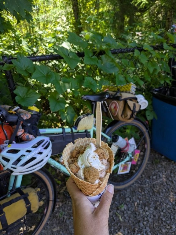
Our lunch stop was at the locally famous Sugar Pine Drive-In located just off the Sandy River. Mostly I wanted their delicious soft serve ice cream (we were on a bike trip after all). Some of us bought lunch while some of us ate our pre packed lunch. Since usually Andrew and I split a package of beans to make a bean burrito I ate half the bag, saving the other half for the next day. (We found bagged cooked beans at our local grocery store! so much more convenient then the cans we usually carry).
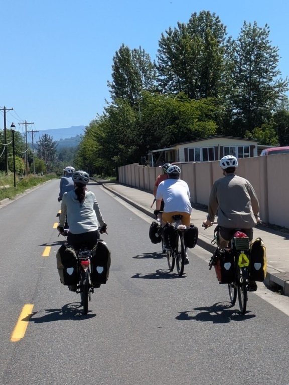
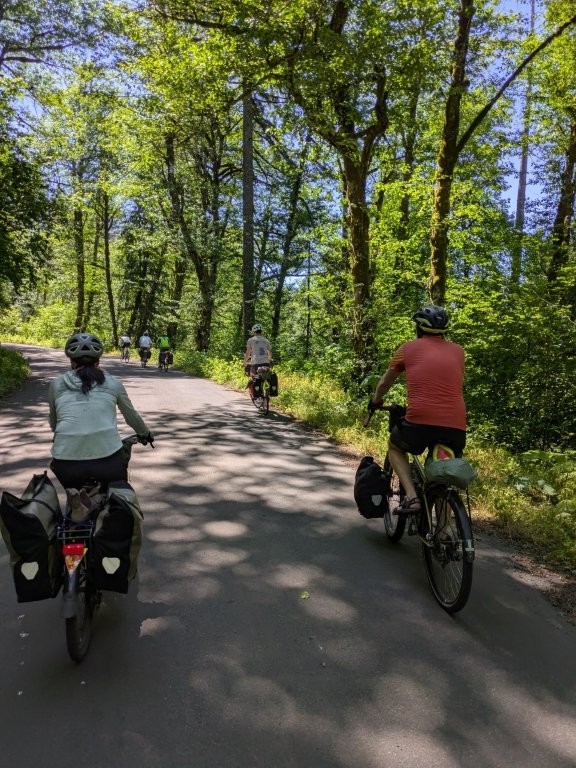
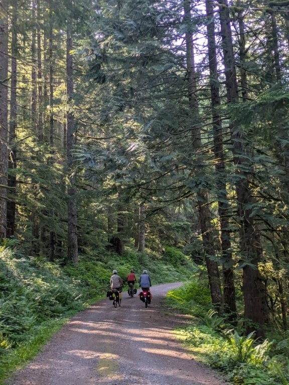
After lunch is when our scenery changed dramatically. We were finally out of the city/suburbs and headed into farmland and forest. This is also where the climbing started, we were going up a mountain after all. In order to avoid some traffic we opted to take some less direct and less traveled roads. Unfortunately the less traveled roads tend to be steeper, and the temperature for the day wasn’t exactly pleasant- the forecast was in the 90s, and a lot of Portlanders (including Andrew and Little John) had opted to hide inside that weekend. At least as we increased in elevation we saw less traffic, and it was slightly cooler on the mountain than it was down in the city – even if it didn’t feel that way at the time.
Thanks to some of those brutal steep stints, some of us ended up walking our bikes for large portions of the ride. At least it’s nice to use some different muscles for a bit. I always remind myself (and others) that walking is your lowest gear!
Are We There Yet?
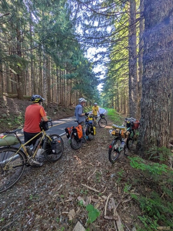
Around 2 we came to to a juncture. One way we were promised gravel, the other more of what we had been on, but both routes about the same in terms of length and elevation gain. Opting for the road likely to have lesser traffic, we all chose the gravel. Except as it turns out it wasn’t gravel, just a poorly paved regular ole asphalt road. Based on my stamina at the time I wasn’t too upset about that, asphalt is much easier and the road was still less traveled by cars – so an overall win!
Around 3 we rolled into the entrance of what Bruce calls “base camp”, a lower elevation nice camping spot on public land. The heat and the climbing had really taken a toll on a lot of the group, so we paused off the road and took a long break dithering about how far up the mountain we actually wanted to go. Me being a completionist, and having yet to summit Larch Mountain by bike, I was gung ho to make it to the top. But also, we were a group and wanted to make sure everyone was having a good time, so Bruce had the idea to make a blind vote about how far up we should go. He built shapes out of sticks to represent our different camping options (basecamp, snow gate, or top) and we all one at a time placed a Douglas Fir cone in a shape to cast our vote. To make sure it was extra blind, I think every one of us one at a time changed our mind and moved our cone to revote. Clearly we were a decisive bunch.
The final results showed 1 for top, 3 for another couple miles to the snow gate, and 3 for staying put. I should note that we did start with 8 folks, but only had 7 votes because Tom had a commitment later that night so he was only riding with us for the day. He came unloaded on his road bike, and after a short pause at the base camp entrance, he actually continued up to the top at a much faster pace so that he could summit and return home for his evening commitment. In the amount of time we spent evaluating our options, and seeing the overall cones on the upward trend, Mia decided she was done with the heat and climbing and ready to go home. She decided to text her partner to come get her so she could relax and sleep in a real bed.

Into the Woods
We were now down to 6. Bruce hung back with Mia until her partner arrived while the rest of us carried on upward. We had another 1000ft of climbing to get to our new destination for the night near the snow gate. At some point Mia and her partner drove past us, they were presumably off to take in the view from the top – She did climb over a third of the mountain after all.
Since we took a nice long break dithering over our options we did at least feel refreshed as we started pedaling again. However, it didn’t take long for the heat to be noticeable again. I opted to fall back to pause at a creek waterfall to wet all my outer layers with the icy water to cool off. It was heavenly.
We regrouped at the snow gate and found a nice place to camp on public land a few hundred feet lower in elevation down a blocked off gravel road where we wouldn’t be disturbed by cars. It was actually a few hundred feet from where Josh, Andrew and some others had camped the year prior while we were hoping to see the Aurora Borealis (I had been too busy to write up a full blog post on that particular trip but I posted a few pictures here– and no, we didn’t see them).
We were a little exhausted after putting forth all that effort climbing in the heat. We arrived to our camp spot around 6 and after setting up tents (or in Leif’s case, hammock) we all gathered round to start dinner and have a sort of happy hour sharing snacks and even wine. (Although too many people brought wine to share so I think Derek ended up carrying a carton all the way up and then back down the mountain!).
Since this was my first time camp cooking without Andrew I wanted to keep it simple (and also make sure I didn’t make too much food). I opted to make fancy ramen for dinner. Not the most ideal dinner after a hot climb, but it gave me the needed fuel to carry on another day.
Unfortunately the bugs were not happy about us invading their space and kept trying to climb into our eyes. A problem Josh and I had conveniently blocked out of our memory from the previous year. Bruce opted to start a small fire to get them to leave us alone. There was even a convenient pile of wood near where we were camping. With the help of the fire we had a lovely evening chitchatting and snacking until it started to get dark and we realized we needed to get our bear hang up, and then we all settled into our respective tents.
As it turns out, only one person in Andrew and my fancy new 3 person Big Agnes bikepacking tent is pretty roomy. But since it was our lightest tent and it also packed the smallest, I wasn’t about to take any of our older tents up the mountain! While I did do a decent job of attempting to pack super light for this trip, I had even borrowed some small frame bags from a friend to limit my carrying capacity. I did still needlessly bring my sleeping quilt – with overnight temperatures in the high 80s it was not needed at all.

June 8, 2025 - To the Top, and Then All the Way Down
Distance: 35.2mi (77.7mi Total)
Ascent: 2144ft (5,577ft Total)
At one point the night before we had entertained the idea of postponing breakfast. Rather than eat at camp, we could finish the climb up and enjoy our breakfast at the top! That’s the talk of someone with a full belly and not in need of their morning caffeine. As morning rolled around it was unanimous that we would enjoy breakfast and coffee at camp.
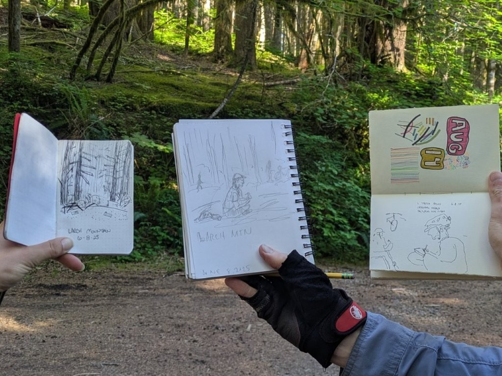
A few years ago after doing a camping trip with Bruce and seeing him do some sketches, I started sketching the various campsites we stay at when we go on group rides. Mostly it came about because with there usually being the two of us Andrew and I would often finish taking down camp and be ready to go before everyone else. I started sketching as a way to busy myself in the morning, and to help keep others from feeling rushed. As it turns out when I don’t have Andrew to help I’m NOT done before everyone else. Thinking I was early I started sketching some trees. Bruce seeing me sketching, decided to whip out his sketch book and sketch me sketching the trees. Derek then wanting in on the fun sketched Bruce sketching me sketching the trees! Who knew we’d have so many artists in the group! We had a good laugh about it before taking off up the road.
Bruce had looked up with his navigation tools the remaining ascent and found that we had 10 miles to go to the summit (with 2 miles being on the gravel road we took back to the main road). Tim and Leif both feeling a little tired and having no real motivation to reach the top opted to take a leisurely morning and head straight down the mountain rather than up first. We were down to a party of four.
To The Top
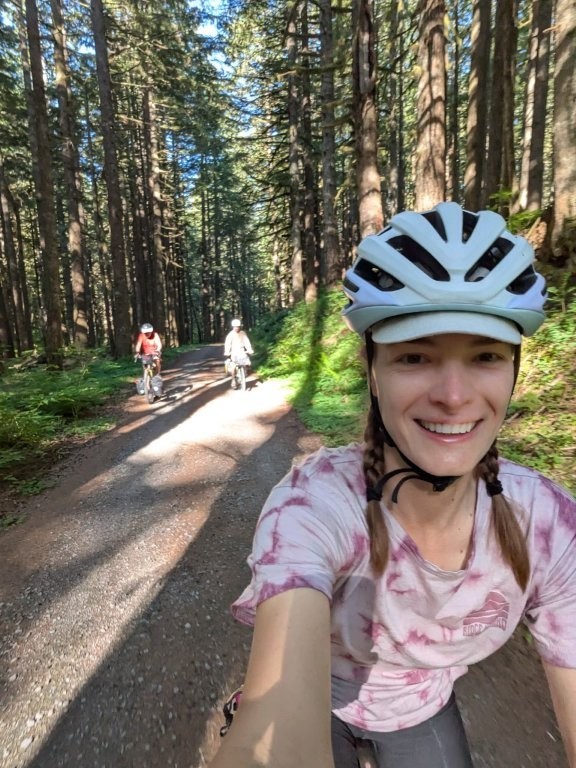
With the prospect of 10 miles of climbing we hunkered down and started pedaling our way up. Being relatively early (we started rolling at 9) we mostly had the roads to ourselves. Although we did get passed by one roadie going twice our speed – I swear you’d think he was going down and not up at how fast he passed us!
While the climbing was rough, it wasn’t too hot yet and the surroundings were lovely. Josh and I kept trying to guess where we had gotten turned around the year prior due to snow, but thankfully there was no snow in sight this year. It was a sweet relief when at 6.5 miles we reached the parking lot at the top and didn’t have to do another 3.5 miles as we had initially thought.
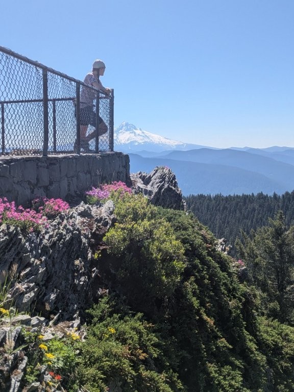
I was hoping to get a picture with my bike all the way at the top. But we could only make it so far on the short footpath before a daunting set of stairs loomed ahead of us. Having loaded down bikes we parked them in the trees and carried on without.
The view was amazing. We were fortunate to have a clear sky day and able to see 5 major Cascade peaks, as well as one bonus mystery peak off to the south! (Mt St Helens, Mt Rainier, Mt Adams, Mt Hood, and Mt Jefferson; based on the map I’m guessing the 6th was Olallie Butte but who really knows.) We hung out at the top for a while, taking in the views, capturing photos, and enjoying snacks – the last stretch was powered by gummy bears after all.


The Long Way Down
Before starting our descent, Bruce noticed a single track trail that he had never ridden that was about a mile long from the top that connected down to the road. Still high on reaching the top, our adventurous spirits won out and opted to take the single track. As is often the case, the trail started out lovely, but once we had gone too far to want to backtrack it switched over to large chunky rocks with lots of roots. We ended up walking our bikes a fair chunk of the trail. I guess it wouldn’t be a Bruce ride without at least a little bit of hike-a-biking. While it was fun and I’m glad we did it, I think next time I’ll enjoy the easy descent on the paved road.
Fortunately there was still plenty of downhill to enjoy. Once we made it back to pavement it was smooth sailing. It felt both amazingly long, and yet I was surprised at how quickly we had popped out at the Women’s Forum (basically the bottom of the mountain).
After Women’s Forum the riding was more of a grind. The temperatures were rising, and we were having to deal with more and more traffic (on top of losing our downhill advantage).
Since the forecast was headed for the 90s, we all decided we would shorten our riding time by catching the MAX from Gresham back to Portland. With that goal in mind we beelined for a taqueria in Gresham with AC to grab lunch before catching the train.


The Final Stretch
Lo and behold, who happened to be catching a ride on the very same train? – Tim who we had left earlier that morning. Apparently he and Leif had dealt with some flats, done a short hike and detoured to Vista House before also hopping on the MAX (although I guess Leif had the energy to ride all the way home).
The light rail was a very pleasant break from the heat, but unfortunately, as seems to always be the case for me in these sorts of situations, they were doing maintenance on the stretch between the Gateway green and Lloyd Center. So after 30 minutes of riding they diverted passengers to shuttle busses.
None of us wanted to deal with the bus bike racks (and not to mention – although I guess I am mentioning it- they only have two racks per bus). We all begrudgingly rode our bikes the rest of the way home, which for me was another 7 miles instead of the 2 I had been hoping for. Fortunately two of the others lived in the same general area as me, so we were able to ride as a group for a large chunk of the way home.
Overall it was a great trip! I had a lot of fun, and am thankful for the century training I had done the month prior, because somehow after all that my legs weren’t killing me (it was mostly the heat). Going up to Larch Mountain has been a fun bikepacking tradition, and I think now that I’ve actually summited I’ll be a little more “go with the flow” and enjoy all parts of the gem of a mountain in our backyard.
You May Also Like

