
Roaming the Columbia Hills
"John Day" Ride
Our friends Erin and Jonathon invited us on a three day bikepacking trip over Memorial Day weekend. During Covid they started a tradition of going on a “John Day Ride” over the long weekend to make sure they get outside. While it may seem like a way to celebrate Jonathon for a day, John Day was a real guy who probably became famous thanks to an encounter with indigenous peoples that left him naked. The river where they were found is today called the John Day River.
Erin and Jonathon don’t have any special admiration for the guy, but it is a fun name, fun story, and that first year they rode around the John Day River Basin. This year’s ride didn’t really have anything to do with John Day, although we did find some petroglyphs that had been MOVED from the John Day reservoir so I guess that counts!
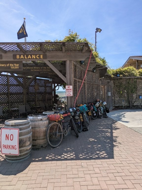
The idea behind this route was that it was meant to be beginner friendly for some friends who haven’t done a lot of bikepacking. As it turns out its a good thing none of those “beginners” showed up because it wound up being much more difficult than anticipated and it might have scared them away from the sport being described as “easy”. The route followed the Klickitat Trail from Lyle, Washington on the Eastern end of the Columbia River Gorge. From there the plan was for us to doodle our way east and ride the Maryhill Loops Road down to the Columbia River, cross at Biggs Junction and then head west on some gravel roads to The Dalles where we would cross the Columbia River again and make our way back to our starting position in Lyle. We mostly did that.

Day 1
May 24, 2025
Mileage: 44.3mi
Total Daily Ascent: 2456ft
The morning started off pleasant. Erin and Jonathon picked us up from our place and after loading up the bikes onto their car we had enough time to grab coffee and breakfast so we swung into Just Bob. As it turns out, one of our other Portland friends, Steve, happened to be grabbing breakfast at the same place before heading out to the same trailhead! Him and his crew were only planning to do a day trip, but still what are the odds? Our group of six ended up leapfrogging with Steve’s group of around eight throughout the day.
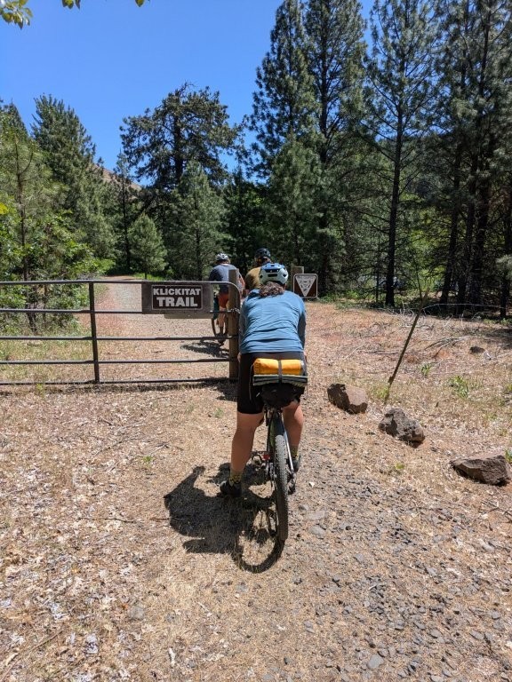
After breakfast we made the hour and a half scenic drive through the Columbia River Gorge to the town of Lyle, WA. Once Larry and Panda met us at the trailhead it was only a short while before we began rolling down the trail. Our goal was to have wheels on the ground at 10, technically that was achieved, but we didn’t actually leave the trailhead until closer to 11.
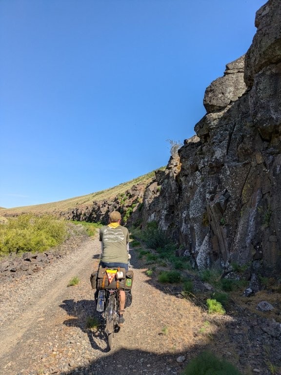
Klickitat Trail
The Klickitat Trail, where our route began, had some wide smooth gravel portions as well as some chunky single track. It was definitely challenging in a lot of places but it was a nice mix of terrain that kept us on our toes, er, pedals. I do think I’m getting better at these sorts of technical rides though!
After an hour or so of riding we rolled into the town of Klickitat with a convenience store living up to its name being conveniently located just off the trail. We all ate our lunches and grabbed some goodies such as the ever important ice cream before carrying on. After lunch there was a small portion of road riding that wasn’t great, but definitely not the worst before we were able to catch the trail again into Swale Canyon. We were happy to be back on the car free trail, but it was getting hot.
Once in the canyon our group spaced out pretty dramatically. Erin took the lead and must be built for deserts because I had gone so long without seeing her I had started to question if I hadn’t somehow mysteriously passed her and she was actually behind me! Temperatures were in the 90s and shade was few and far between. The terrain was gorgeous, but the mind starts to play tricks on you in the heat, especially when you go long stretches without seeing anyone else.

Eventually Erin and some of the others who had caught up to her took an exceptionally long break allowing the rest of us to catch up. I could tell they had been waiting a while simply based on the small amount of shade available in their chosen spot – clearly it had been more when they chose to stop there.
Eventually we made it out of the canyon giving us slower folks a little confidence boost. At Harms Road (don’t ask me why it’s called that) we said our goodbyes to Steve’s group who would be circling back to Lyle and we carried on eastward. There was another final mile or two of unimproved trail past Harms Road but Jonathon was the only one brave/strong/dumb? enough to take it. The rest of us opted to follow the road paralleling the trail which we thought was gravel, but turned out to be a paved road, a nice break from the gravel. Even though we were on paved road and Jonathon on essentially a mountain biking route, somehow he managed to meet back at the junction at the same time as the rest of us. Some people are just built different.
The Hills Keep Going Up Until They Go Down
Once all together we had one more major climb on a gravel road. The surface of the road wasn’t bad, but the steepness was god awful. Our group split pretty quickly as some of us stopped to rest in the only shade to be found. This climb did come with some amazing views of the mountains to the north, we decided it was Mt Adams, Rainier, and Goat Rock Mountains probably. I spent a lot of time admiring the mountains – it definitely wasn’t because I needed the time to rest or anything.


The speedy folks waited at the top of the climb for the rest of us and we all celebrated as we made it to the top of our ascent around 2300ft elevation. Now it was around here that Erin realized she had made a dreadful mistake. Our intended campground for the night was in Columbia Hills State Park. That’s a 3000+ acre state park sitting on the Washington side of the Gorge with elevations ranging from basically 0ft to where we were currently standing at 2300ft. When she had been plotting the overall route, she had taken us to the middle of the state park at an elevation of 1270ft. Our campground however was not in the middle of the state park, but instead at the edge, the edge of the park way down by the Columbia River almost 1300ft lower than our planned end spot. The down wasn’t the problem, that bit was great, but the prospect of having to climb back UP to get back on track was a daunting one.
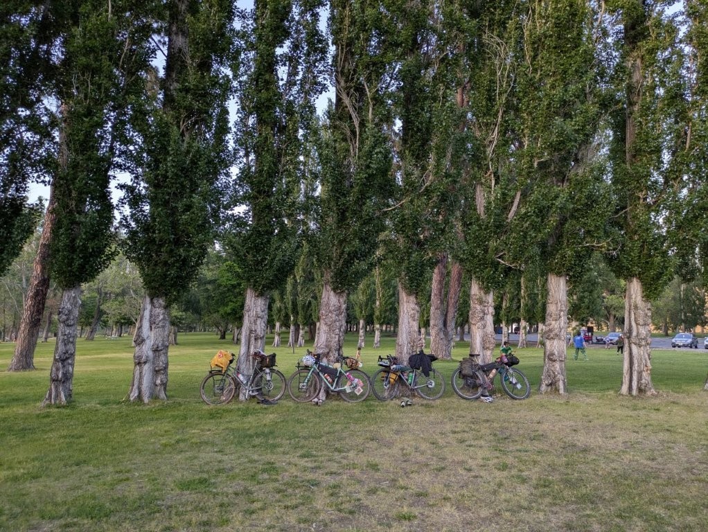
After the briefest consideration of wild camping at the higher elevation (water was limited, and we had all been looking forward to showers) we decided we would revise day 2’s plan to be something different because no one wanted to do another 3000ft of climbing after how rough day 1’s climb had turned out to be. With that decision in mind we were able to truly enjoy the downhill riding all the way to the river. I’m amazed my brake pads don’t need replacing because they definitely got some use on that descent. Somehow Jonathon wasn’t as wiped out as the rest of us as he even opted to take a mountain biking trail down rather than the main gravel road, and we still barely beat him to camp.
Horsethief was the name of the actual campground within Columbia Hills State Park. We arrived at a reasonable hour took turns showering (there was only two for the whole campground), then ate dinner, discussed our options for the next day and quickly fell asleep in our respective tents.

Day 2
May 25, 2025
Mileage: 34.3mi (78.6mi Total)
Total Daily Ascent: 2146ft
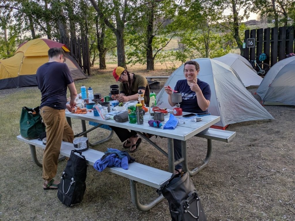
We woke up to a very windy campground. As it turns out it had been unusually calm when we had arrived the night before. Fortunately nobody lost anything, but Andrew and I did have part of our tent come detached from our stakes. Our fancy new Big Agnes bikepacking Tent (Copper Spur HV UL3 Bikepack) is amazing in so many ways, but it came with weird ultralight stakes that don’t have enough of a hook to keep the tent attached to them. Erin taught us a trick she does with hers, but I think we’ll wind up buying new stakes at some point.
Near the campground were the petroglyphs I mentioned at the start of the blog. Those of us that were ready faster opted to make a detour over to check them out. Very cool to see art that has survived so long.
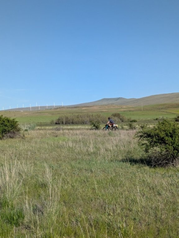
After our camp elevation debacle from the day before, our new plan was simply to follow Highway 14 east to the Briggs Junction bridge (rather than going up and around as had been originally intended). The highway that far east was surprisingly decent, with shoulders that were both smooth and wide and traffic was relatively light.


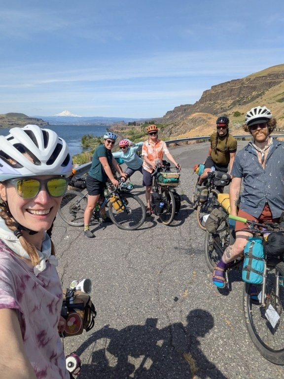
The highway itself was still hilly though, with an overall increase in elevation. We regrouped pretty regularly at pullouts – especially if they came with shade. Apparently Erin even found a herd of mountain goats sheltering in the shade that the rest of us missed.
Sam Hill and His Legacy
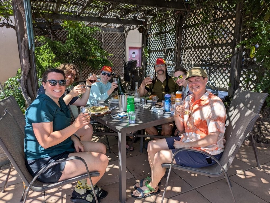
We started the morning with intensions of going to Maryhill Museum and then back tracking slightly to go to the Maryhill Winery which didn’t open until 11. But as it turns out, we were riding slower than anticipated and the winery was open by the time we actually got there so we opted to stop there first. We had a nice long lunch break, some of us opting to order food, and others opting to lighten their loads by eating the food they were already carrying. But everyone enjoyed some wine.
After probably two hours we rolled out of the winery and continued east. It was getting late enough that we opted not to go into the museum this time, but we did at least swing down to check out the outside of the house and sculpture garden. As we were getting ready to hit the highway again, Larry finally figured out why he had been having a weird noise coming from his bike. One of the pawls in his free hub broke off. Who needs all of them anyway? (For the record I still don’t really know what that means, I’m just repeating what they told me.) After some fiddling, Larry was able to get his wheel to run smoothly with the help of Andrew’s olive oil stash since no one had chain lube on them. He’ll need to get his bike looked at more thoroughly, but it got him through the rest of our ride at least.
Our original route had us coming down the hills on the Mary Hill Loops Road, a historic 3.6 mile car free paved road that has a max grade of 5%. Our group split in two, some of us opting to ride the Maryhill Loops, while others opted to head straight for camp. Since we were starting at the base of the loop road, we had to ride up them first. We stashed our gear in some bushes at the base of the loop road to lighten our loads and began climbing. It was slow going going up. But other than two folks walking up the hill with a luge dragging behind them, our group of 4 were the only ones out there. After resting briefly at the top, we enjoyed the sweet sweet decent. Although the “loops” were just a little too intense for me to allow myself to go too fast, I did have to use my brakes a lot – good thing all that downhill gravel the day before didn’t wear them out!
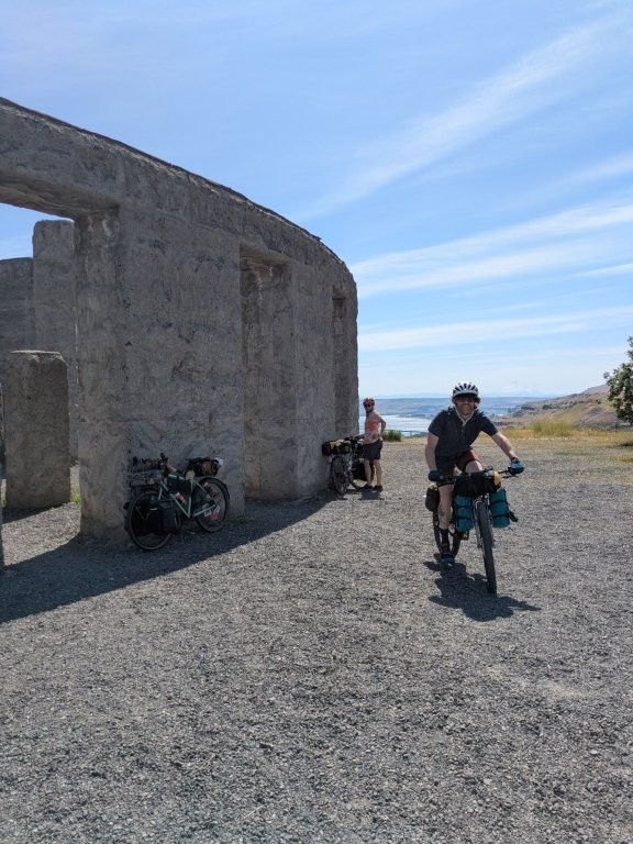
After leaving the Loops Road we zipped past the Stonehenge Memorial on our way to Biggs Junction. I probably would have stayed to take more pictures, but I needed a bathroom and the monument had let me down as far as opportunities went. Fortunately I did find a port-a-potty outside a farmer’s market closer to the Columbia River. The Sam Hill Memorial Bridge into Biggs Junction, OR is a narrow one with no shoulders so our group opted to take the lane on the bridge so we wouldn’t have any cars pass us too closely. Especially with the strong gusty winds I was happy to not be riding too close to the edge of the bridge.

Crossing State Lines
Once on the Oregon side we pulled into a McDonalds. Jonathon and Erin had been talking about getting a McFlurry here before we even started riding. Of course Andrew and I were more than happy to oblige and partake in the indulgence. We even ordered fries for good measure.
The last 5ish miles into camp were relatively flat but they came with a not so nice headwind and it was all highway shoulder riding. Fortunately traffic wasn’t too bad, and Larry even got a train to honk their horn for him.
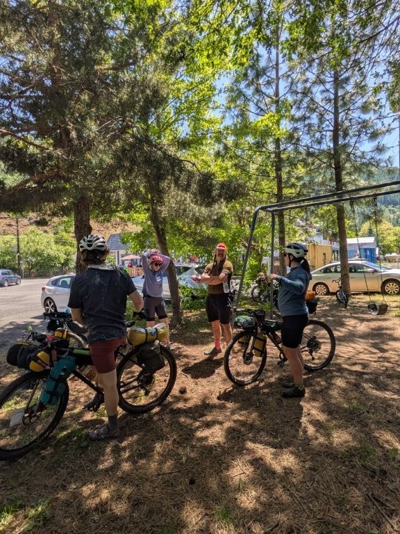
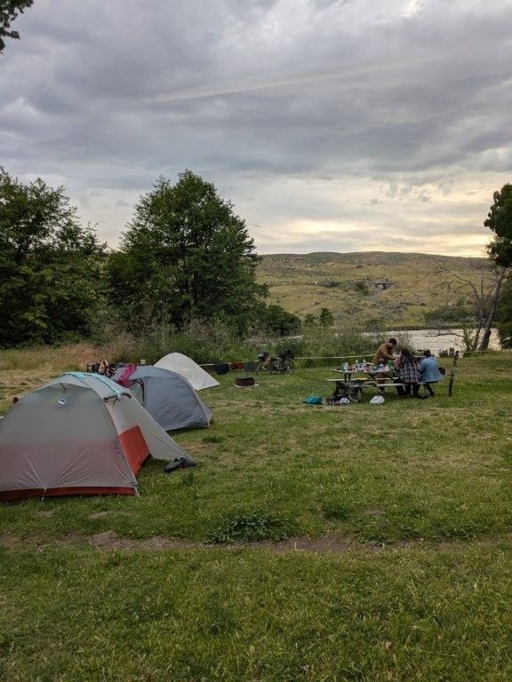
Today felt very leisurely compared to the first day, so when we rolled into camp at a very reasonable hour some folks opted to get in the Deschutes River just off our camp site. Jonathon still having riding energy decided to go ride up the Deschutes River trail. But mostly our group just hung out and chit chatted until we decided it was late enough to start dinner.
Day 3
May 26, 2025
Mileage: 28.9mi (107.5mi Total)
Total Daily Ascent: 1843ft
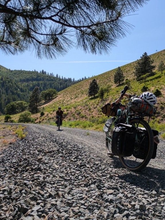
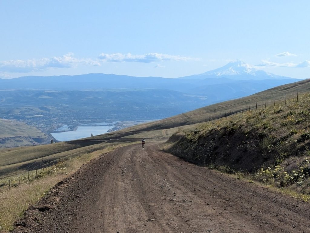
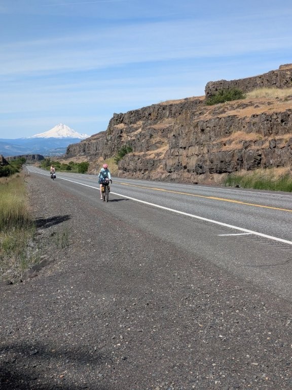
As should be expected heading west in that part of the gorge, our final day would be full of headwinds. The first half of the ride would be gravel, and it came with a gnarly climb right out of the gate. In fact we had been admiring it from across the Deschutes River the night before.
The gravel portion in particular was actually a bit that Andrew and I had done on our Eastern Oregon Adventure 2 years prior, almost to the day. But, having been going the opposite direction that time, we had had a glorious tailwind on that previous ride. Regardless of the wind direction, well I guess our direction with respect to the wind, the views were still stunning.
When we hit pavement we again split into two groups, some folks choosing to have an easier ride staying on pavement and going around a small hill, and the rest of us sticking with less trafficked gravel roads but also going over the hill. One car did pass us though. I’m actually glad I chose the gravel as it was a new to me road, and wasn’t too bad of a climb. The downhill was enjoyably mellow thanks to the headwind keeping us from going too quick. (Andrew’s Note: The four cars we saw on the paved route were going the opposite direction, and we watched as the first one turned and passed the group on the gravel hill. So it’s not like the paved road was a terrible choice.)
We regrouped and made our way into The Dalles, OR for lunch. We briefly considered a local place but it was a little too busy for our liking (some folks were on a deadline to get home) so we opted to carry on to the McDonalds where Andrew and I supplemented our packed bean burrito with too many fries and I got myself a third and final ice cream for the trip.


As the Wind Blows
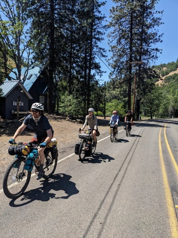
The Dalles bridge back to Washington was surprisingly pleasant. It had a decent sized sidewalk and was very smooth. The problem instead was that pesky wind I keep mentioning. It had been progressively growing all day. Once in Washington we were a lot more exposed to the elements. The state welcomed us with a crosswind and a few miles of shoulder riding.
We were able to take a break from traffic on a farm road for a few miles mooing at the cows and neighing at the horses we rode past. But eventually we did have to get on the shoulder of highway 14 in order for us to get back to Lyle. Unlike the section we had ridden on the day prior, this shoulder was much smaller, and the traffic was much heavier. On top of that it was a full on headwind for the 6 miles back to our vehicles.
Honestly that last stretch was a a slog, I zoned out as much as I could tucking behind Erin in order to gain what little draft I could, so as you can imagine there aren’t very many pictures from this stretch. Our group for the most part had the same mindset and we all rode in a little pack. I do remember seeing a few kite surfers out on the Columbia River, but for the most part those last six miles were a blur, I was focused on the wheel in front of me hoping we would be there soon. We did get to go through a tunnel which was nice. Scary, but fun. It came with a bike button at least, but I’m not sure the warning lights worked.
We did eventually make it off the highway and back to our vehicles. Yes it was a hard trip, but it was a lot of fun, and it’s always great to hang out with other like minded souls. And, as it turns out, training and riding a century a few weeks prior, really gets you in shape for a crazy bike packing trip like this one!


You May Also Like


2 Comments
Bruce Bateau
Sounds like a real variety of conditions. Glad to know one can ride across the Dalles bridge. What wildlife did you encounter?
Anonymous
Yeah I believe the hood river bridge is the only one you aren’t allowed to ride across, but the sidewalk on the Dalles bridge was definitely nice!
As far as wildlife, not a lot haha. We did see a killdeer protecting it’s nest. That was cool. Erin saw those mountain goats. We saw a snake at the winery that had a questionable enough shaped head for us to keep our distance, but probably was harmless. That’s all I remember seeing out there