
Katy Trail Ride – A Learning Experience
Overview
Drove from Kansa City to Sedalia, MO (1.5hours)
Amtrak Train from Sedalia to Kirkwoood Station (3 hours)
Bike Stop Cafe Van Shuttle from Kirkwood Station to St Charles (15 minutes)
Riding around town and East on Katy (11.9 miles)
Rode from St Charles to Marthasville with lunch in Augusta. (43.9 miles)
Rode from Marthasville to Jefferson City with lunch in Hermann (73 miles)
Rode from Jefferson City to New Franklin with lunch at Cooper’s Landing (58.6 miles)
Rode from New Franklin to Sedalia with lunches on the trail (41.6 miles).
(Then drove the 1.5 hours home)


Day 0 - The Travel Day
Wednesday, April 10, 2019
Kansas City to St Charles
Daily miles: 11.9
We had a long day of travel ahead of us, so we woke up pretty early to make sure we had time to load the car and get a decent breakfast in. We had a 1.5 hour drive to the train station in Sedalia. Our train didn’t leave until 10 am, but we wanted to make sure we had plenty of time to unload the car, do some last minute checks on the bike, and take some pictures, etc, so we gave ourselves plenty of buffer time arriving at the train station around 8:30 am. While we were taking pictures the developer of a new multi-use project, Lamy’s, across from the train station came over to talk to us. It sounded like a really neat project – and hopefully it’s up and running the next time we decide to do the Katy.
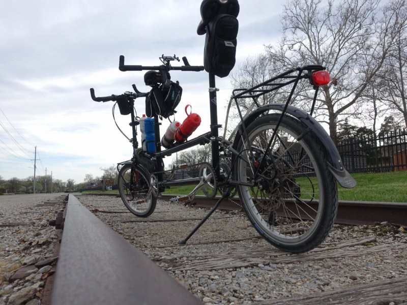
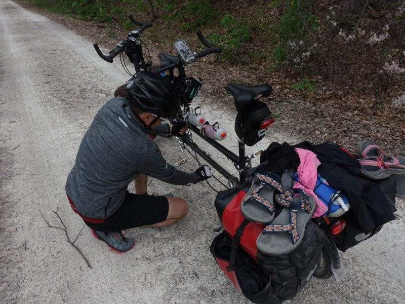
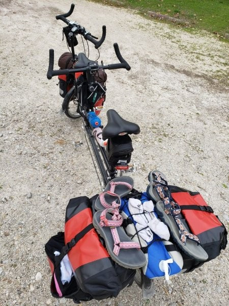
Before the trip, the train ride was what I was most anxious about. This was because the Amtrak website explicitly states that tandems aren’t allowed on the train. (Our back up plan was to fold the bike and check it – but we REALLY didn’t want to have to deal with that hassle.) Sure enough, as the train rolled up next to us, the conductor’s first words were “Uh, I don’t think we can take tandems” to which we quickly responded by simultaneously saying “it folds” and folding the back wheel under. Luckily for us the guy wasn’t a stickler for rules and said “alright, if it fits then it’s fine”, and let us on the train. First challenge complete! The train ride itself was pretty uneventful – we played cards, ate our packed lunch, and even got in a short nap. For those of you who’ve never ridden one, it’s not a bad way to travel – you are free to walk around and have a lot more leg room in general than when compared to a car or plane. (However, American trains have their whole set of drawbacks just because for the most part Amtrak doesn’t own the rail line – but I won’t get into that here). After the train we had a quick shuttle into St Charles – our starting destination. Tony, our shuttle driver from Bike Stop Café, was ready to take us as soon as we got to Kirkwood. He delivered us to our hotel (America’s Best Value Inn) where we learned our first lesson – ‘always request the first floor’. I had waited outside while Andrew checked in, and so when he asked for a first floor they told him they were reserved for certain upgrades, so Andrew didn’t argue too much. (They did change their mind on their 1st floor rule when we brought the tandem inside, but we decided it wasn’t that big of a deal and crammed it in the elevator – another win for the folding bike!)

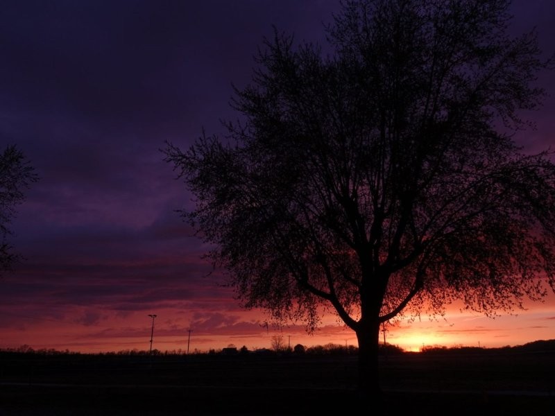
Since we had arrived in St Charles around 2pm, and the weather was gorgeous, we decided we would take the bike out (unloaded) just to make sure everything was working properly after our travels. The eastern most point of the Katy Trail is in Machens, MO at mile marker 26.9 – basically the middle of nowhere. St Charles, where we started, is mile marker 39.5. We decided to ride east on the Katy Trail since we would be going west in the morning. We made it to mile marker 35 (so about 5 miles) before coming to a barrier and a sign saying the rest of the trail was closed due to flood damage – so for all intents and purposes – we did start at the eastern most end. After riding back into town, satisfied that our bike was ready for the journey we treated ourselves to some tea at Bike Stop Café, and did a little wandering through the historic downtown. St Charles has a really cute downtown, and I was disappointed we didn’t have space in our panniers to buy anything from any of the shops.
We wanted to make sure we were well rested and fed, so we ended our day with some burritos from QDoba, and watched the end of the 4th Harry Potter movie on TV before going to sleep.


Day 1 - The First Day
Thursday, April 11, 2019
St Charles to Marthasville
Daily miles: 43.9 (55.8 total)
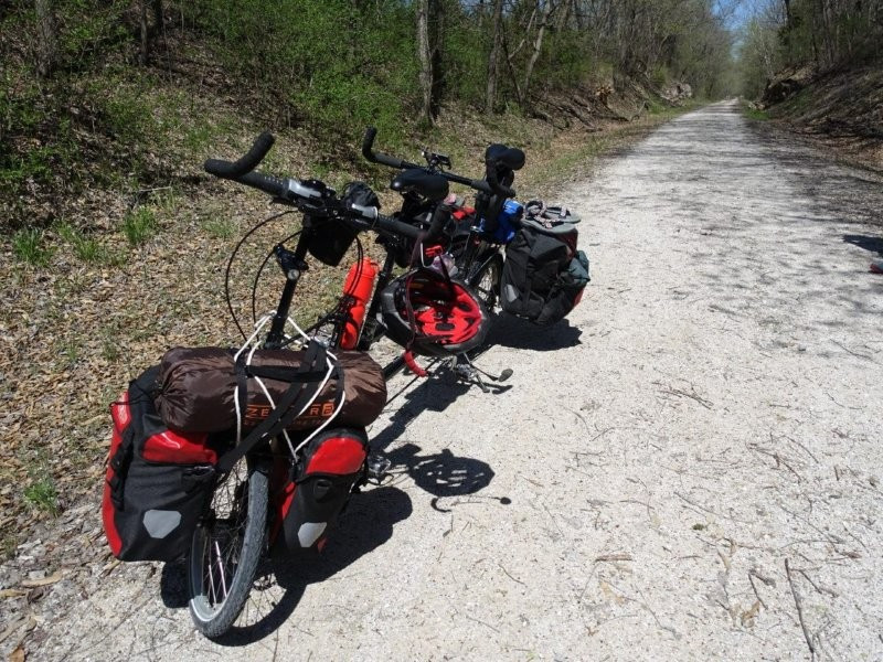
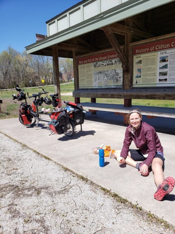
We started off our day in great spirits only leaving about 15 minutes later than planned. The hotel breakfast was exactly as expected from a budget inn (I had half a waffle, yogurt and a hard boiled egg). As we were heading out the door the hotel concierge even asked to take a picture of us with our loaded tandem – gotta love our crazy Bike Friday Bike. Our itinerary said we had a 40 mile day ahead of us – and surprisingly we got this one pretty close. Another big lesson we got out of this trip was always assume there will be more miles than planned – but I’ll get into that on Day 2. We had a general idea of how long it would take us to do those 40 miles, but we weren’t really sure – turns out pretty slow. Especially when I was happy to stop and take pictures of basically everything along the way. (I did notice that the more tired I got, the less eager I was to stop to take pictures). I think it ended up taking us about 45 minutes to get to the first trail head (Greens Bottom at mile marker 45.7) and of course I had to take several pictures there.
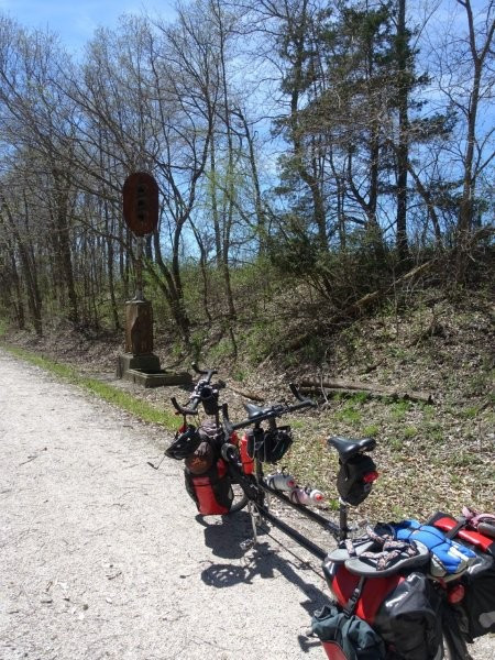
Every trail head along the Katy has a map of the entire trail, as well as a zoomed in map of the trail from where you were to the next trail head in either direction. It also include information on what to expect and what to look out for, so they made for great stopping spots. They also had a community board portion where local restaurants and hotels could post advertisings. Oh, and they all have the ever important toilet. Some even came with drinking water.


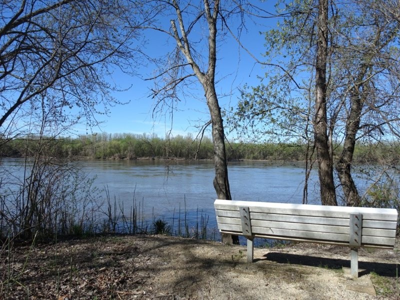
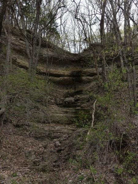
The scenery of the trail along day 1 was lovely. To the left was fields: some were flooded (bringing a nasty stagnant water stench with them) but most of the fields were covered in purple wildflowers and it just looked amazing. To the right was a completely different scene with forests and giant bluffs that towered over us. The wooded hillscape often made me think of the orc battle at the end of the first Lord of The Rings movie.
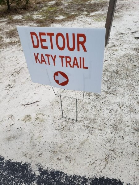
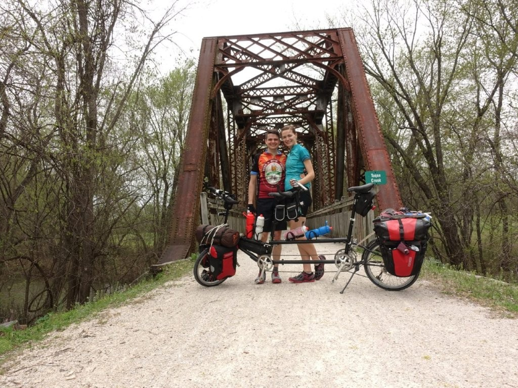
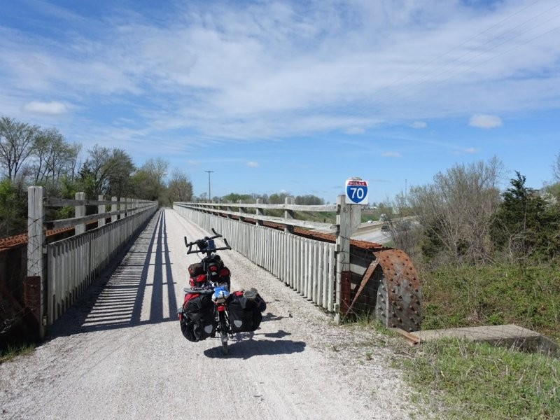
Two weeks prior to our ride there had been major flooding along the Missouri river. Since the Katy Trail mostly follows the river, we had at least one detour a day to avoid portions of trail that had been damaged from the flood waters. Today we only had one major detour near Klondike Park. We ended up following one of the “Lewis and Clark trails”. It was a really pretty trail and very well marked, but unlike the smooth gravel of the Katy, it was a little rougher of a ride, and more annoyingly, it wasn’t as flat. We did end up having to get off and push our bike up a hill – the steep switchbacks were clearly not made with tandems in mind. The detour did take us past a really cool looking lake that didn’t feel like it belonged there compared to the rest of the scenery.
Around 11:30 we rolled in to the town of Augusta (mile marker 66.3) to stop for lunch. We were disappointed to see that the Augusta Brew Haus was closed down with a for sale sign (they had been a really lively place last time we were in the area) but we were happy to stop at Kate’s Coffee instead. On our way to Kate’s we had run into another couple from Dallas riding across the Katy trail, but in the other direction. They were also planning to get lunch at the Augusta Brew Haus only to find the same sign we did, so they were also looking for Kate’s Coffee. It was nice to chat with them about the trail – especially since the ride itself had been pretty devoid of people since it was still early in the season. Kate’s Coffee is located farther into town off the trail, and essentially at the top of a very big hill. They have a policy where if you ride up the hill on your bike they’ll give you a free mini-muffin. Sadly, we had taken the less direct hill approach to catch up with those other cyclists, and the turns plus the hill were no match for us, and again we ended up pushing our bike for about 7ft – so no free muffin for us. But the purchased pastries were still just as delicious!
Earlier in the day while riding we had heard a very loud, very ominous boom. I thought it was thunder foreshadowing a terrible storm about to hit us, while Andrew thought it was a cannon. Since at the time we had been right by a gun range and heard shots shortly thereafter, it seemed to make sense so we took it off our mind. Apparently what it had actually been was the implosion of a bridge over the Missouri out in Washington (outside of mile marker 74) – so that was pretty cool. Too bad we didn’t actually see it happen though.
After lunch was a pretty, quiet, uneventful ride as we finished up in Marthasville (mm 77.7). We made a quick detour to the grocery store then headed to our campsite – which was really just a giant shelter and grassy area between two baseball diamonds. I guess we were the first guests for the season because when we called Don to check in he realized the hot water at the facilities wasn’t working. So instead of paying the expected $10 to camp he gave us the site for free. Let me tell you that seemed like a pretty sweet deal until I went to take that ice cold “shower” especially considering the nightly lows were in the high 30s low 40s. Our first night of camping was off to a rough start.
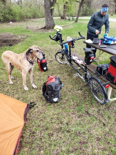
We decided to set up our tent under the shelter because rain was expected in the forecast. The downside to that though was that being on concrete, we couldn’t stake the tent down. Normally that wouldn’t be a big deal (that’s why we bought a free standing tent) but that particular day had been extremely windy. Setting up the tent was a real struggle. We had weighted the tent down with our bags thinking that would be enough. There was one particularly strong gust of wind that came through taking everything with it – including our bike! At that moment we realized staying under the main shelter wasn’t going to work. We relocated up next to the bathrooms under the stairs trying to block as much wind as possible and it worked! But the wind definitely made for a long night as we could hear the wind rushing around us.
I’m glad we had gotten to this campsite early because it allowed us to get showers in before little league practice started at both baseball fields. We were probably starting on dinner as the kids started to show up. It was a little annoying having to wait for all the kids to leave before feeling like we could get ready for bed, but you gotta do what you gotta do. Andrew even wound up playing kickball with some of the little league kids’ siblings.
Another lesson learned: only store light things in the tent gear loft over our heads… Andrew had tripped on the tent causing a headlamp to fall and cut my lip. At least this was the only casualty of the trip.
If interested, you can read about all our meals (including recipes) here.


Day 2 - The Long Day
Friday, April 12, 2019
Marthasville to Jefferson City
Daily miles: 73 (128.8 total)
We set our alarms pretty early because we knew we had a long day ahead of us. It ended up being much longer than the original planned 65 miles. Apparently we had forgotten to include the spur trails into town in our mileage estimates, and then when you add in the detours it was 8 miles longer than expected. Our hope had been to leave camp by 7 am. But it’s real hard to get out of bed when it’s dark and freezing out, so our actual start time wasn’t until around 8. Andrew cooked breakfast (and the ever important coffee) while I attempted to pack up the sleeping gear. It is really hard to stuff gear into their tiny bags when your fingers are frozen!
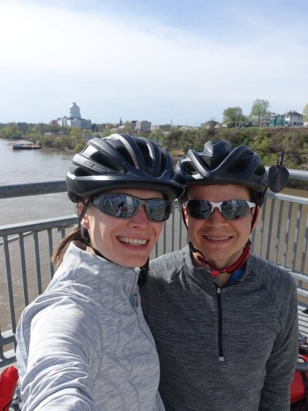
After having such a rough night (and knowing we had a long day ahead of us) we made the executive decision to stay in a hotel the next night – and I’m so glad we did. (Our original planned campsite outside of Jefferson City was a primitive campsite so there really wasn’t anything to look forward to there). We made reservations at the Capital Plaza Hotel in Jefferson City (mostly choosing it because it was marginally more expensive than the cheapest hotel relatively close to the trail, and this one came with a whole bunch of bonus Southwest points.) Later we saw advertisements for it on some of the trail heads so it worked out being really nice. Hindsight, we should have gotten a hotel in Hermann, or Portland, or Mokane, or Tebbetts, or literally anywhere closer than Jefferson City (mm143.2).
The first sign of trouble came right as we started with our first technical difficulty. Our speedometer wasn’t working. Andrew played with it for a while, but eventually gave up, so we had to rely on the mile markers. Our speedometer did occasionally start working again when we hit a large bump, but its inconsistency will need to be sorted before our next bike trip.
The trail on day 2 had a lot more pastures than the day prior, so we saw a lot more farm animals. The pastures also brought with them more exposure to the elements. For almost the entire day we were fighting a 17mph headwind. (I took a screenshot of the weather as proof, so that’s no exaggeration!). Day 2 was rough. We kept longing for tree tunnels, because with them we got small breaks from the brutal wind. The wind was so demoralizing. All around us we saw even animals struggling – in one comical instance we saw a goose struggling to stay in the water of a flooded field because the wind kept pushing him to the edge. We tried to listen to audio books (with our custom made TOTM speaker bag) which normally works great, but Andrew couldn’t hear the speaker over the intense winds so we had to give up on it anytime we were in a clearing.
After about 4 hours of riding we had only managed to make it a third of the way (23 miles). We stopped in the town of Hermann (a 2 mile spur off the main trail from McKittrick (mm100.8). We decided on Mexican and went to El Ranchito, which for a Mexican restaurant had a surprisingly limited number of vegetarian dishes especially for a Friday during lent. The food wasn’t anything to write home about, but the waiter was friendly, and we were able to fill up our water and rest for a bit.

After replenishing our strength we continued on not too optimistic about the rest of our ride, but being gladder and gladder we wouldn’t be camping that night. Even with the miserably long ride, there were some fun wildlife moments we got to experience. At one point we saw a bald eagle fly right by us, carrying a dead rabbit or some other prey with it. We also came up to a house weirdly covered in turkey vultures – but I wasn’t about to investigate why they were there. Later we rode past a creek where there were at least a dozen turtles all squeezed on a log attempting to bask in the sun – but as I went to get my camera out to take a picture, they all collectively dove into the water. Andrew jokingly called them ‘trickster turtles’ claiming they did it on purpose.
Due to our long ride, made slower by the wind, we ended up stopping at the Mokane trail head (mm 125) to cook dinner around 6 pm. Eating at the trail head made us feel like real bike packers – but it wasn’t very motivating knowing that we still had 21 miles to go to get to our hotel. At least the wind had died down a little after dinner (and its amazing, you really can tell a difference between 17 and 12mph headwinds!). The last 21 miles was an impressive push to the finish line as we raced the sunset. We lost, but it was a valiant effort. We rolled into the hotel at around 8:15 pm utterly exhausted.
The Capital Plaza hotel gives free breakfast to all Katy Trail Riders which was a pleasant surprise (and sounded way better than our planned oatmeal). Checking in was a bit of an ordeal just because they had to figure out where to put our bike (no first floor rooms, and glass elevators). Their normal bike storage room just isn’t long enough, so they ended up keeping it in one of the conference rooms, which worked out just fine for us.
Sleeping in a hotel does wonders for the morale. And the hot shower felt amazing. Being in a hotel also gave me a chance to ice my knee. I’m pretty sure I overexerted myself with the long ride giving me some pretty bad knee pain for the rest of the trip (and into the following week). In the past year I’ve been to 2 doctors and 2 different physical therapists about my knee, with no one really knowing what’s wrong other than my knee tracking isn’t the greatest. I really hope this won’t be a recurring problem for me. We did learn that we need to max our planned days out at 40-50 miles – that way when detours/wind happen we don’t overexert ourselves too much again.


Day 3 - The Best Day
Saturday, April 13, 2019
Jefferson City to New Franklin
Daily miles: 58.6 (187.4 total)
After such a long day, we decided to let ourselves sleep in a little bit and set the alarms for 7am with a plan to be out by 9am. We actually did manage to make it out of the hotel by 9, but we had about a 30 minute detour to a nearby convenience store to get more protein bars and Andrew took the opportunity to lube our dusty chains and fix the timing chain tension. Prior to leaving we were able to treat ourselves to that free buffet breakfast. It was so good, and exactly what we needed to start the day!
The weather was also much nicer on day 3. The wind was down to around 5mph, and it was also more of a crosswind. Being a Saturday, and near Columbia (college town) there were also a lot more cyclists, and people in general out and about so it felt a little less lonely.
The morning went by pretty uneventfully, although we did have the first of two times a stick knocked our timing chain off the bike. We stopped for lunch at Chim’s Thai Restaurant at Copper’s Landing (mm163.5) and it was perfect. This lunch was probably my favorite thing from the whole trip. Chim’s was essentially just a food truck, located next to a barbecue place and some campgrounds. It was situated right next to the river, and they had several tables as well as a stage with an open mic. The food, atmosphere, and weather just made it a prefect lunch break. (Also I love me some Thai food!) If we do the trail again we will definitely be stopping here.

The day 3 ride was full of detours. And as I mentioned before, the detours never seemed to be as flat as the Katy Trail. The first detour was just outside Easley (mm 62.5) and it was the most scenic. It took us a little ways out from the bluffs so we could actually see them (instead of being right up against them). I wish I was a better photographer because it was gorgeous, with the purple flower fields in the foreground, and the bluffs in the background with the blue skies. The detour itself was onto a farm gravel road, so it was pretty rough. While I was enjoying the scenic views, Andrew was having to focus on the road dodging the bigger rocks making sure we wouldn’t run into any trouble.

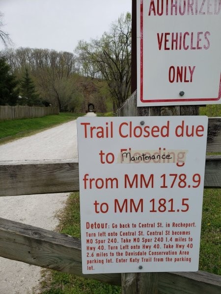
The 2nd detour was much less pleasant. This detour was just past Rocheport (mm178.3). Unlike the other detours this one wasn’t marked along the way, instead it had a sign with directions. The detour led us onto a very hilly highway with basically no shoulder – it was not a very pleasant road to ride on. With the downhill portion we did manage to make it up to 35 mph though!
Before we realized that 2nd detour existed, we had decided to reward ourselves for doing so well on time with tea and pastries at Merriweather Café in Rocheport. (It also helped that the predicted rain forecast kept getting pushed back later and later in the evening). The break was lovely – on future rides I hope to have more flexibility in our schedule to make stops like those! (Meaning we will definitely be planning less miles per day).
Being a nice weather Saturday. There were several people out. Including boy scouts. There was one portion where there was probably 50 of them essentially blocking the road. As we tried to pass, the adults kept telling the boys to get to the right, and they just had no idea what was happening. Later at the campsite we ran into two other troops taking up probably one half of the tent sites. Other than the scouts the campsite was deserted.
We camped at the Katy Roundhouse Campgrounds (mm189) just past the New Franklin trail head (mm 188.2). We did have to go a little past the camp site to get some groceries from Snoddy’s, but we managed all right fatigue wise. (My knee seemed to be doing a little better on day 3 compared to day 2). Checking in was a little confusing – mostly because we weren’t sure where to go and had an older phone number, but once we found the “after hours” check-in spot we were fine. (You check-in in a house like building at the Northwest side of the trail. So it’s across the trail from the actual campgrounds). We called the owners with the number posted at their after hours check in to get a key code to the shower house, and made our way to a campsite. We had picked one that was a good distance from the boy scouts (and shower house) and seemed like it would be relatively protected from the wind – after that first night we didn’t want to take any chances. Dinner went well (rice and beans) although we were finishing up as the sun was setting (not to say that it was pretty, because it was too cloudy to tell other than that it was getting darker). We managed to set up camp and get showered (yay hot water!) and were in bed by a decent time. I had the ladies restroom side to myself which was great! Andrew had an interesting encounter with a scout from the shower: “Woah someone’s actually using the shower!? Usually they don’t work at places like these!”


Day 4 - The Last Day
Sunday, April 14, 2019
New Franklin to Sedalia (and then home)
Daily miles: 41.6 (229 total)
The anticipated rain had shown up overnight. We had gone to sleep with everything tucked up under the rain fly vestibules and when we packed up it was satisfying to see the odd tent shaped dry spot on the ground. We thought we had gotten lucky when we awoke to a lack of rain, but as Andrew had just started to heat up water for our coffee and oatmeal the rain picked back up again. I was able to stay dry by packing up our sleeping bags and pads from inside the tent. We did end up eating breakfast in the tent (which I’m pretty sure is a big no-no, but it is what it is.) The rain did eventually stop, so we were able to finish packing up camp and getting our gear back on the bike without too much stuff getting wet. This was a pleasant surprise – because the original forecast said it would be raining until noon! It had also predicted snow which I was very glad didn’t happen.
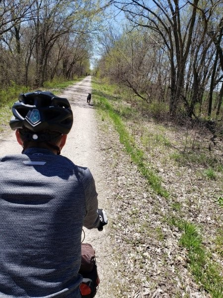
As we were finishing packing up camp we saw our first dog of the day – a massive friendly great dane. He came over in hunt of the bacon the scouts were cooking in the distance, after slobbering all over my leg he realized we didn’t have what he was looking for and continued on further into the campsite. We saw 3 more dogs on our last day. The 2nd dog was also very friendly. He ran alongside us on the trail. It was super cute until we realized he had been following us for about 3 miles. Worried he would get lost, we did all we could to get him to go home but it was no use. It wasn’t until we passed a farm with free range chickens (aka they were on the trail) that the dog got distracted and we were able to lose him. The 3rd and 4th dogs unlike the first two were mean. They were together, and they did not like us going past their territory. They didn’t actually bite at us or anything but they did aggressively bark and chase us for about half a mile. We will probably look into pepper spray or something to help us out for situations like those! I will say having a dog angrily chase you is excellent motivation to pedal faster though.

Budget
$68 ……. Amtrak Train (2 people + 1 bike)
$65 ……. Bike Stop Cafe Shuttle (Kirkwood to St Charles)
$88 ……. St Charles hotel
$120 ….. Jefferson City hotel
$20 ……. Katy Roundhouse Campsite
$37 ……. groceries
$109 …. dining out – meals
$17 ……. coffee/snacks on trail
$524 ….. Total Spent
*does not include pre purchased snacks
More Pictures
You May Also Like

3 Comments
Pingback:
Pingback:
Pingback: